Commercial Surveying Services
BFA offers a variety of commercial surveying services. With over 55 years of experience, the Professional Surveyors at BFA have the competency to deliver detailed results, on schedule and within budget. Our experience combined with a strong working knowledge of state and local regulations allows our survey team to provide a high standard of service for every client we serve.
ALTA/NSPS Survey
Why is an ALTA/NSPS Survey Needed?
Title companies and lenders often request an ALTA/NSPS land title survey, especially in the event of a sale, refinancing or transfer of a parcel of commercial property. This type of survey shows more detail than other surveys and provides necessary information for sale or transfer approval.ALTA/NSPS Surveys Typically Show:
- Location and elevation of structural improvements on the property (buildings, fences, roads, etc.)
- Zoning setbacks for the property
- Information on property easements and their complications
- Information on neighboring property owners and possible encroachments
- Public road access
- Location of water features and/or water boundaries
American Land Title Association (ALTA)
National Society of Professional Surveyors (NSPS)
This type of survey is most commonly performed on commercial property and is the most comprehensive type of survey.
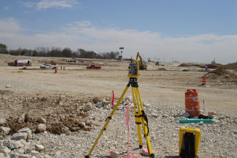
Construction Surveys
A Construction Survey (also known as construction layout or construction stake-out) is a survey that presents locations and marks for construction activities. This type of survey creates a visual layout of the construction plans on the property where the structures will be built. Using the construction plans as a reference, the surveyor places stakes throughout the build site to mark the location and dimensions of each element and structure to be built. This includes any buildings as well as the location of roads, walkways, curbs, plumbing, and drainage grades across the property.
A Construction Survey is Important
Construction staking helps reduce the risk of error by ensuring everyone involved with the construction knows precisely where each element must be placed. For a construction project to be completed according to specifications, construction staking must be performed with a high level of accuracy by a licensed and experienced surveyor. BFA has experience working for municipalities, MODOT, and contractors to stake-out the exact location and/or the elevations of streets, buildings, structures, or other improvements required to complete the proposed design improvements.
Construction Surveys (staking) involve laying out and staking of various features and structures such as buildings, curb and gutter, and various utilities.
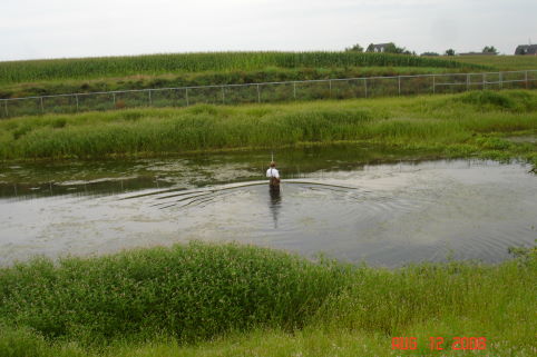
Topographic Survey
A Topographic Survey depicts the elevations or “lay of the land” and is typically used in the design of land development that includes grade changes and underground utilities. This type of survey is the basis for earthwork calculations and the proper design of stormwater drainage and sanitary sewer infrastructure improvements. In many cases, commercial property development requires a detailed survey of the existing physical features on the property.
The resulting topographical map will identify elevations drawn as contour lines showing the relative heights of the ground throughout the property. The map will mark all physical and man-made features on-property, including trees, hills, trails, roads, streams, poles, manholes, etc.
When is a TOPO necessary?
A TOPO survey is often conducted on commercial property for any of the following reasons:
- Identify the optimal building site on the property
- Identify water runoff patterns on the land and create drainage or grading solutions to divert drainage away from structures
- Resolve current standing water issues
- Optimal planning of additional infrastructure, such as roads and utilities
- Evaluate possible effects of development on the landscape
- Requirement to obtain permits from local zoning authorities
Topographic Surveys (TOPO) depict the elevations or “lay of the land”, and are typically used in the design of land development that includes grade changes and underground utilities.
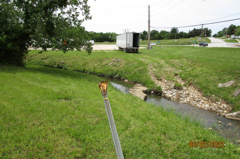
Right-of-Way (ROW)
A Right-of-Way Plan Contains the Following Information
- Land Survey Lines (i.e. Quarter Section Lines) and Property Lines
- Parcel Identification Numbers
- Names of Property Owners
- Existing Easements (such as utility corridors) and Right-of-Way
- Proposed Easement and Right-of-Way (for development projects)
Right of Way (ROW) Survey is commonly defined as a rite of passage to another person’s land or property.